“The ultimate goal of farming is not the growing of crops, but the cultivation and perfection of human beings.” – Masanobu Fukuoka
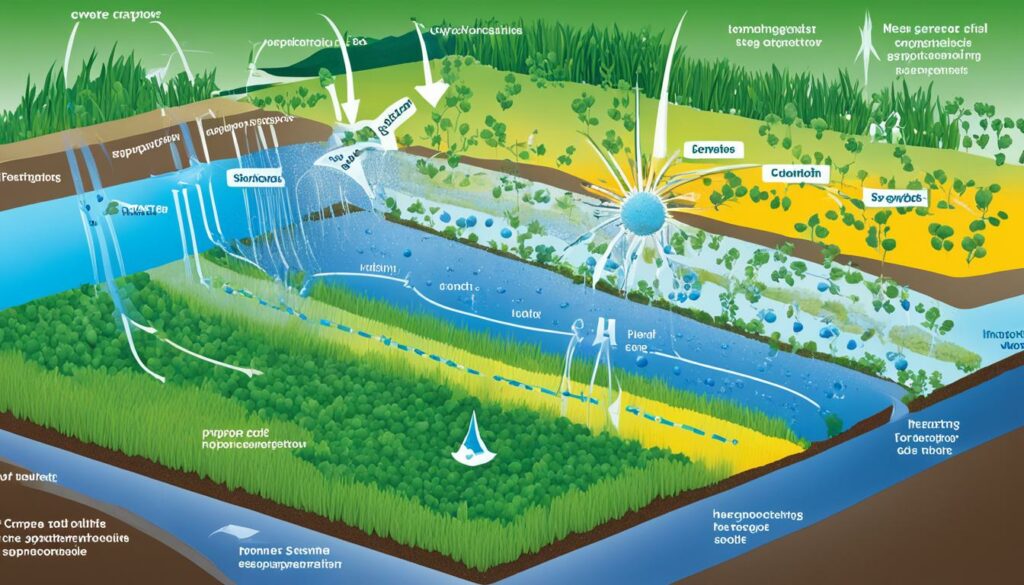
Remote sensing agriculture leads the way in using technology for farming. It gives us deep insights into crop health and how to manage it. This is done using advanced hyperspectral remote sensing. It’s amazing for improving how we grow crops.
With this tech, we can spot when crops are stressed and figure out the best ways to use water on them. The use of all light’s wavelengths has really helped us farm more precisely.
It’s not just about the fields, though. This technology also helps in understanding global changes and makes farming more resilient to climate issues. As specialists discover new ways to use it, we see how crucial this in-depth analysis is for farming today. These tools are key for making sure we farm in a way that can feed our growing global population sustainably.
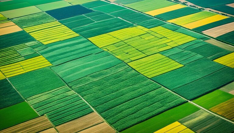
Remote sensing agriculture is a high-tech way to learn about crops and nature without touching them. It helps us better use and look after our farming areas. By using special tools to watch over crops, we find problems early. We also save water and spot changes in the landscape down to small details.
This field covers many ways to use technology in farming, like choosing where to plant more or less and how much to feed them. It’s key because it helps find what’s wrong with plants – like not enough nutrients or too much water – early. This lets farmers act fast. It’s not just farmers who use these tools; people who give loans look at the land with it, too. This shows how important technology is for making farms work better.
Remote sensing in farming started in the 1950s with simple tools. Today, it’s very advanced. These tools see visible light and infrared light to tell us about plant health. For example, plants look green when they are full of life. But not all green looks the same. By knowing the differences, we can find out which plants need help the most.
More recently, we’ve made special measurements like the NDVI to see how healthy plants are. This kind of data helps everyone in farming do their jobs better. However, clouds can get in the way of taking pictures from the sky. So, we keep making tools that work better no matter the weather.
Hyperspectral remote sensing is key in today’s farming. It provides detailed data across light, infrared, and heat. This tech is vital for precision farming, giving deep knowledge on plants. It helps spot plant issues and improve how farms are run.
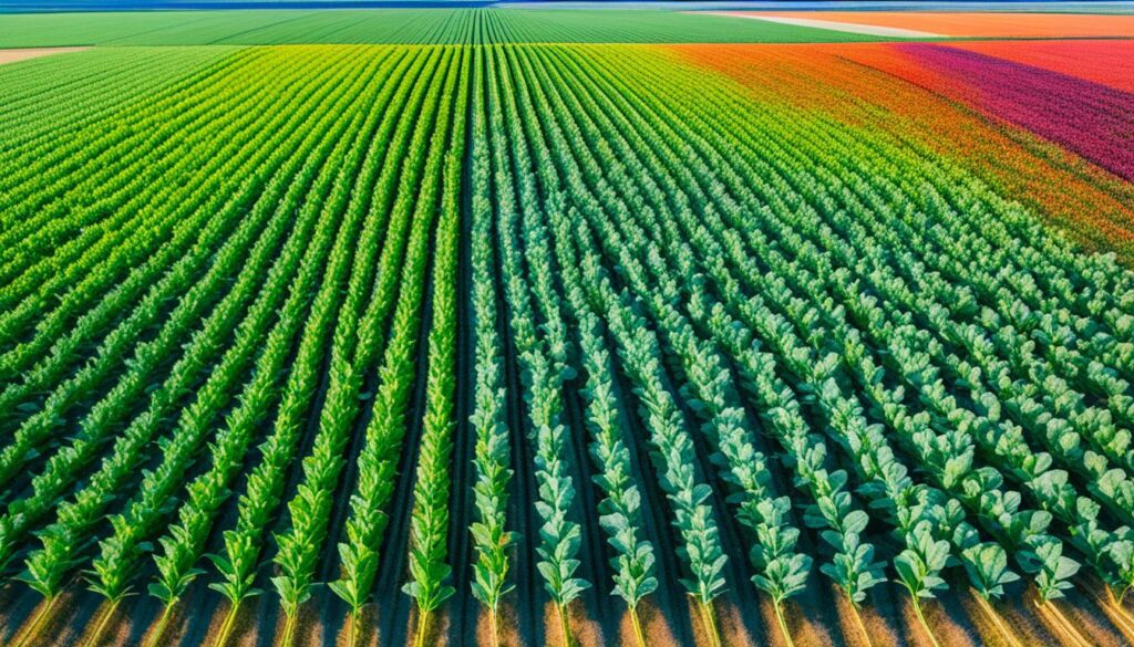
Looking closely at plant colours is crucial in farming. Hyperspectral cameras can see many shades at once. This lets farmers study plant health and check soil details. It makes farming methods better.
Using hyperspectral data is great for plant care. It shows how water-efficient plants are and finds stress early. This tech also fights plant invaders and checks soil health. Knowing these specifics helps plan water use and deal with pests.
| Parameter | Benefit |
|---|---|
| Nitrogen Content | Ensures Optimal Fertilisation |
| Crop Phenology | Tracks Growth Stages |
| Crop Water Productivity | Enhances Water Management |
| Crop Stress Detection | Enables Timely Interventions |
| Soil Parameters | Improves Soil Health Monitoring |
Precision agriculture works hand in hand with remote sensing. It uses various methods and tools to give farmers detailed information. This includes data on soil, weather, and the effects of climate change. With a rising need for food, precision farming becomes key for future sustainable agriculture.
Satellite images, GIS, IoT, and AI are vital to precision farming. They help make farming more efficient. By analysing large amounts of data and using machine learning, they offer detailed views from space and the air. This helps farmers with things like watching over crops and predicting yields.
Irrigation and keeping an eye on diseases and pests are made better through IoT. This type of technology can control water systems and monitor for problems. It makes farming smarter, using less resources and protecting crops better.
Precision agriculture coupled with remote sensing offers many benefits. It makes irrigation smarter, saving water and meeting crop needs perfectly. Also, it helps in controlling diseases precisely, so crop protection is effective without overusing chemicals.
Satellite imaging gives farmers up-to-date info on crop health and what crops might need. In California, using these methods in agriculture made a big positive economic impact. It led to better crop yields and saving resources.
| Technology | Application | Benefits |
|---|---|---|
| Satellite Imagery Analysis | Crop Health Monitoring | Real-time data, Yield Optimisation |
| IoT Systems | Smart Irrigation | Water Efficiency, Reduced Input Costs |
| AI and Machine Learning | Yield Prediction, Crop Stress Detection | Enhanced Decision Making, Risk Mitigation |
| UAV Imaging | High-Resolution Mapping | Detailed Analysis, Flexible Data Acquisition |
Precision agriculture and remote sensing together change the way farms are managed. They offer insights and solutions for modern farming challenges. This leads to a sustainable and productive future in farming worldwide.
Remote sensing agriculture is changing how we track crop health and growth. It uses satellite images to help farmers monitor their crops. This tech lets farmers watch plant health, soil moisture, and temperatures closely.
Today, a smart system for monitoring crops does a lot. It helps with everything from collecting data to making decisions. Farmers can use real facts to make their crop growing better, leading to bigger harvests.
There are many ways to monitor crops, such as looking at them or checking the soil. Farmers use these methods to find and stop pests from hurting their crops. They can also prevent pest outbreaks by keeping an eye on the weather.
Drones and planes are now part of monitoring crops from above. And satellite imagery analysis is used a lot too. This high-tech approach is making farming more productive and strong.
Crop monitoring gives farmers the power to grow their crops better. This tech is changing the game in how we manage agriculture.
Satellite imagery is a powerful tool for tracking crop health. It allows us to scan large areas quickly, giving us detailed insights. We get real-time information on how plants are doing, if they are stressed, or at what stage of growth they are.
Satellite technology takes detailed pictures of fields from space. It uses different light bands to show us various aspects of plant growth. For example, Sentinel-2 satellites take pictures every 5 days from above. They show us the health of crops with their bright and near pictures. Landsat4-9 satellites watch over bigger areas, even though they take pictures every 8 days. However, they are very helpful in checking on a lot of crops at once.
One big metric is the NDVI, which tells us how healthy plants are. It goes from showing dead plants to those doing very well. It’s really useful, even though sometimes clouds can get in the way. These metrics are crucial in spotting crop problems early.
Satellites can also check the amount of leaves, how much chlorophyll the plants have, and if they need water. For example, the Airbus Pleiades satellites take pictures very clearly, showing us even small changes in plant health. The daily pictures from Planet SkySat help farmers make choices fast, using very exact details. This could help them use less water while keeping their crops healthy.
Here is a quick look at what each satellite system can do:
| Satellite System | Imagery Type | Repeat Cycle | Spatial Resolution |
|---|---|---|---|
| Landsat 4-9 | Multispectral | 8 days | 15, 30, 100 meters |
| Sentinel-2 | RGB, Multispectral | 5 days | 10 meters |
| Planet Scope | RGB, Multispectral | Daily | 3-4 meters |
| Planet SkySat | Panchromatic, Multispectral | Daily | 0.5 to 0.71-0.82 meters |
| Airbus Pleiades | Multispectral | Daily | 0.5 meters |
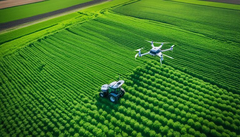
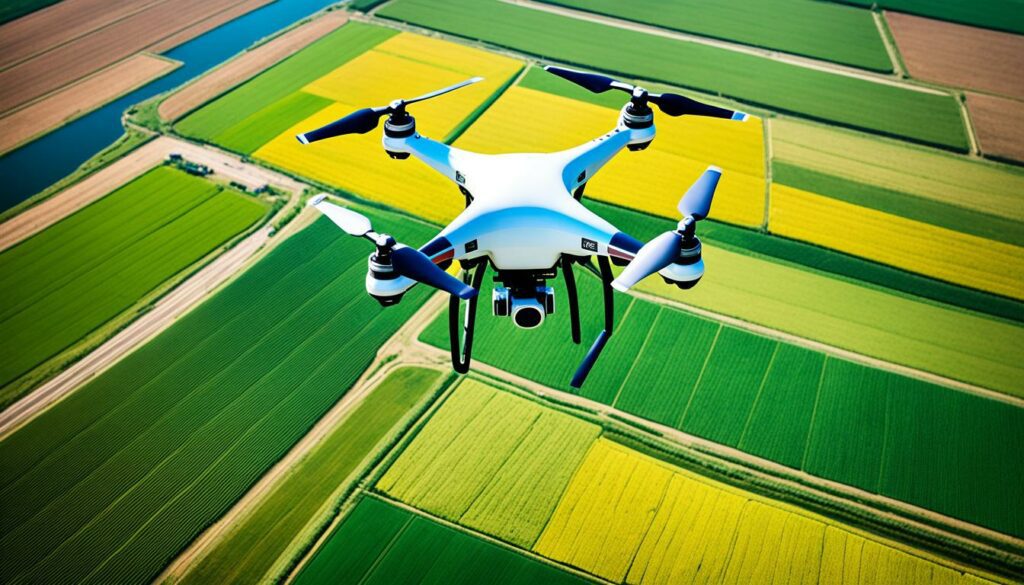
Drone technology in agriculture is becoming a key part of farming today. Since 2016, experts in 20 states have worked hard to make drones useful in farming and managing nature. They focused on careful farming, teaching people through guides, meetings, and online help about drone rules and uses. This work has not only made drones more common but has also made farming more environmentally friendly.
There are a lot of good things about using drones in farming. Drones can take very detailed pictures and collect data quickly. This means farmers can keep an eye on their crops well, spot small problems early, and fix things fast. Also, using drones can make spraying fields with pesticides more precise. This saves money on chemicals and helps the environment.
Drone use in farming has brought new ways to take care of crops. Experts have made drones and sensors that are good at finding problems early, are not too expensive, and easy to use. These tools are great for finding pests and diseases in different crops. They also help with checking how much water plants need, quickly looking at lots of plants, finding lost animals, and checking food quality.
But drones are not just for watching crops. They are also really helpful in looking at the environment on a big scale. For example, drones can give very clear pictures to help predict floods and manage water better. This is very important for farming in places where there is not much water or where there are other big challenges.
| Application | Details |
|---|---|
| Pest and disease scouting | Enhanced scouting in fruit, nut, and row crops |
| Plant water stress monitoring | Accurate detection of water stress levels |
| Stray livestock detection | Efficient tracking of livestock movement |
| Forage quality assessment | Rapid and detailed forage quality analysis |
| Water quality monitoring | High-resolution data for flood risk assessment |
The market for agricultural drones is growing fast. It was worth $1.2 billion in 2019 and is estimated to be $4.8 billion by 2024. These drones can increase the amount of crops grown by up to 5%, which is a big help for farmers.
To sum up, as we use drones more with crop monitoring technology and careful farming methods, we are changing the way we manage crops. This is making farming both better for the environment and more productive.
Soil moisture sensors are a game-changer in farming. They work by measuring the soil’s water content. This helps farmers know exactly how much water their crops need, improving how water is used.
These sensors usually look at one spot’s soil moisture and temperature. However, some can also check for saltiness. Probes can examine moisture levels in the soil up to four feet deep. This makes watering plants much more efficient.
There are a few types of sensors. They all give important information for farming. For example, tensiometers can tell if plants are stressed by checking the soil’s water potential. Others, like capacitance sensors, look at how much water is in the soil.
Soil moisture sensors are vital for saving water. By using these devices, farmers can water crops in the right amounts. This is useful for those who use hydroponics, where water is reused. They use sensors to adjust the nutrient levels for plants.
Some sensors even work from space. They are helpful in places it’s hard to monitor directly. These special sensors can check the moisture in the ground everywhere, even in remote places.
By combining sensor data with weather forecasts, farmers get smart recommendations. This way, they can take good care of their soil and crops. The latest sensors can easily connect with other systems on the farm. This makes tracking data and making decisions easier and faster.
Soil moisture sensors are key for precise farming. They help with watering right, keeping plants healthy, and using less water. This is good for the environment and helps grow better crops. Farmers who use these sensors find them very valuable.
Spectral imaging analysis is changing agriculture. It gives new insights through special techniques. These methods use hyperspectral remote sensing to get crucial data. This helps improve how farms are managed and increases productivity.
In agriculture, two main spectral imaging types are used: hyperspectral and multispectral. Hyperspectral imaging looks at a wide range of wavelengths. It’s detailed, letting us identify many plant and soil properties. Multispectral imaging, on the other hand, looks at fewer wavelengths but is still useful for agricultural applications.
Hyperspectral imaging has its challenges, such as dealing with lots of data and finding patterns in it. But, thanks to deep learning and CNNs, handling these images has become easier. This makes the technology better for use in farming.
Many real-world projects show how useful spectral imaging is in farming. Startups in AgTech are using airborne sensors and AI to make farming more efficient. They can find exact crop nutrition needs, spot diseases early, and improve the way we develop new plants.
UAVs are also a big help. They can carry hyperspectral sensors and gather a lot of detailed data quickly. This is vital for increasing food production to feed the growing world by 2050.
In Finland, researchers did something amazing in 2016. They made an iPhone work as a hyperspectral scanner. This makes this advanced tech easier to use in small farms and remote places.
Companies like Gamaya are making a big difference, too. They create light and smart hyperspectral cameras. These cameras help us know more about plants and soil than our eyes can see. They help make farming more sustainable.
Hyperspectral imaging isn’t just for watching crops. It can do much more. This tech can tell us about the land, find pests, and help save nature. While we’ve used the NDVI for a long time, hyperspectral imaging gives a lot more detail, helping us see things we couldn’t before.
As the market for hyperspectral cameras grows, we’ll see more of this tech in farming. Although it’s not easy to manage all the data this tech provides, its benefits for farming are clear. It’s set to change the way we farm for the better.
Remote sensing is vital in spotting crop stress, its use pioneering back to the 1950s. It finds stress early caused by diseases, lack of nutrients, or not enough water. This helps in farming with more precision and might stop losses in yield. With hyperspectral remote sensing, farmers can dive deep. They can spot tiny differences in plants. This helps them act fast.
Hyperspectral remote sensing beats other tech at pinpointing crop stress signs. It uses specific wavelengths to uncover issues like too much water or insect harm. This info is key for fighting problems early. NDVI is a key tool for this. It measures how healthy plants are, helping in spotting stress.
Thanks to new tech, this kind of sensing is now within reach for many farmers. It offers a super close-up look at crops. And, it breaks down light details to help in-depth analysis. This tech also lets us see small changes in shade, reflecting tiny differences in plant health. Plus, it allows for regular checks, which is great for keeping track.
Besides checking crops, remote sensing is handy in a lot of ways. It helps with putting just the right amount of fertilizer or pesticide where needed. This saves money and is better for our planet. It also helps those raising animals. They can find the best places for their animals to eat. And make sure lands aren’t overused.
People who lend money for farming can also use this tech. They can see if the land is being well looked after by comparing images. This helps everyone in farming do better. With all these uses, remote sensing is now a must-have for modern farming.
The process of remote sensing starts with the sun’s energy hitting plants. This is picked up by a device, checked at a station, and put on maps. This gives farmers info they can act on fast. It helps them deal with plant stress and manage their land better overall.
Efficient crop water use is vital for farming sustainably, especially with less water available. Knowing how much water crops need helps a lot. Now, using special tools like remote sensing, we can measure this accurately. This new way is changing how we manage water in farming, making it more effective and friendly to the environment.
Knowing how much water different plants need is key to using water well. For example, in the Zayandehrud River Basin in Iran, almost all farms use irrigation. It’s important to figure out how much water each plant needs there.
This area gets between 63 mm and 1281 mm of rain, depending on the place. With so many crops grown there, like wheat and barley, it’s vital to manage water carefully for each one.
New technology is helping us better manage water for plants. Things like soil sensors and satellite images play a big role. They make it easier to know how much water crops actually need.
There have been huge steps forward in recent months. A student and a researcher got special training. They wrote two important papers on measuring crop water use. These papers are helping everyone learn more and do better.
Some of this new knowledge was shared at big science meetings, like the American Geophysical Union. Places where many experts come together. This sharing made it clearer how to measure crop water use well.
The project also wrote three articles for science journals. Two of these were in a top remote sensing journal. They talked about predicting crop water needs. These articles are helping us get better at managing water for plants.
All these efforts are helping farmers use water smarter, which is good for both the crops and nature. By using precision agriculture and new technology, we’re making farming more efficient and sustainable.
Exploring land cover through remote sensing helps us in agriculture. It gives us a closer look at how the landscape changes. This understanding is vital for making good policies and managing the land well. Advanced remote sensing lets us keep an eye on what crops are growing and how land is being used.
Maps of land use and cover are key for managing water supplies. Making these maps right involves looking at how complex the area is, the details in the data, and how the maps are made. To make these maps, experts use different methods like ML, SVM, trees, and RF. Each method has its own good points.
ML is known for doing a great job with lots of details in the data. SVM is liked because it can deal with really complex images well, even with only a bit of training. RF uses many trees together for a strong approach to make these maps.
Adding extra data can make mapping even better. A tool called NDVI helps a lot by showing how much plants there are. This is a big help in keeping an eye on crops.
“The Anderson Classification Scheme, taken from the NLCD, is a key way to group land uses and covers. This method helps keep data in line and makes detailed studies easier.”
We’ve got a table that looks at land use and cover numbers from different places:
| Category | USFS (million acres) | BLM (million acres) | ERS (million acres) | NRCS (million acres) | USGS (million acres) |
|---|---|---|---|---|---|
| Forest/Woodland | 751 | 11 | 671 | 409 | 600 |
| Permanent Pasture/Range | – | 158 | 614 | 529 | – |
| Cropland | – | – | 408 | 390 | – |
| Urban Areas | – | – | 61 | – | 102 |
| Rural Parks/Wilderness | – | 2 | 252 | – | – |
| Others | – | 85 | 232 | 504 | – |
Remote sensing and crop checks give us important information on how to use the land. These studies help us find the right balance of growing crops and taking care of the land for the future.
Global change studies in agriculture are very important. This is because climate change is drastically changing our world. These studies explore how climate change affects crop production. They promote using practices in farming that help crops survive bad weather and disasters. Remote sensing technology plays a huge role here. It gives us data on the health of crops, their growth, and how much they produce. This helps farmers use their land and resources better.
Climate change affects crops in many ways, depending on where they are and what they are. For example, changes in how we use land have influenced a big part of the world. From 1960 to 2019, about a third (32%) of the global land area has changed because of what we do on it. This means farmers have to keep adapting, as the land they farm is always changing.
Remote sensing technology helps us understand these changes. It can predict the weather, guide how we grow crops, and warn us about possible disasters. This tech shows how different crops react to extreme weather. For example, crops that are watered grow better in the heat. But places that are high up don’t do as well.
In light of climate change, we need to farm in ways that don’t harm the environment. With the world needing more food, we’ll probably see more farms using water. But we know we need to farm smarter. Remote sensing gives us important information. It tells us about water levels, how healthy the crops are, and how they are doing overall. This guides farmers to use water and land wisely, even as the climate changes.
One key part of smart farming is to watch how land is used. More land is being farmed in some places, but less in others. And as we try to feed more people, we must also protect the environment. This requires careful planning to make sure we farm in ways that are good for everyone, and for the planet.
| Region | Land Use Change | Impact |
|---|---|---|
| Developed Countries | Increase in Forest Areas | Enhanced Biodiversity |
| Developing Countries (Global South) | Decrease in Forest Areas | Soil Degradation, Habitat Loss |
| China | Pasture Expansion | Increased Livestock Production |
| Brazil | Pasture Expansion | Tropical Deforestation |
Using smart farming methods means we can grow enough food without damaging our planet. And with technologies like remote sensing, farmers can actually do better. They can get more crops without hurting the climate. This leads to farming that is strong and can handle whatever comes its way.
In recent times, advanced remote sensing tech has become vital in farming. It allows for extremely detailed mapping and models. Gone are the days when farmers had to walk their land. Now, they can check crop health over vast areas from afar.
There are several kinds of remote sensing in farming. These include detecting light, seeing different light colours, feeling heat, and sending radio waves. Such tools help with making maps, watching the environment, and handling disasters. This all boosts how well farming works.
Using both satellite and on-the-ground data helps even more. It brings about precision farming, meaning more crops with less waste. As our sensors and ways to study data get better, we can do even more in farming.
For instance, the OPTRAM method is a great success when used with satellite data. It has spotted droughts in the U.S. and Mozambique. This research proves how crucial detailed maps and models are in farming.
“The TERRA-REF platform in Maricopa, Arizona, exemplifies the cutting-edge of agricultural technology, featuring a 30-ton steel gantry with hyperspectral Vis-NIR and SWIR cameras for detailed crop analysis.”
Moreover, remote sensing can now check how wet the soil is with special tools. These detailed maps help farmers do things like water plants and fight off pests better. This improves how much food is grown and how kindly it’s grown.
Remote sensing and precision farming are boosting agriculture’s efficiency and output. Since 1997, there have been big steps in photo quality for farming. Now, we can study up to 4046 points for every acre, which makes farming smarter and faster.
Soon, more than 50 new satellites for watching land will be up in the sky. They can see things from the size of a yard to a few miles accurately. They also have tech to look at plants at 5-nanometer detail. This means we’ll be able to spot problems in crops very early.
With the help of Geographic Information Systems (GIS), farming is getting more organised and insightful. It combines maps with detailed data from satellites. So, farmers and experts can make better choices. The info is getting faster, better, and cheaper to help farmers succeed.
Farming with remote sensing might be tricky and need experts, which can be expensive. But, it promises smarter and stronger ways to farm. By 2030, technology from space will likely make big changes in farming. It’ll grow more food while caring for the land, ready for the challenges ahead.
Remote sensing agriculture means using high-tech ways to study crops from afar. It helps us understand and look after farming land better.
Precision farming, or precision agriculture, uses remote sensing for in-depth analysis. It looks at soil, predicts weather, and monitors climate. This makes watering, fighting diseases, and predicting crops better.
Hyperspectral remote sensing looks at light in many narrow parts of the spectrum. It’s great for farm work. It helps check nitrogen in soil, watch how crops develop, and see how well they use water.
Satellites take big pictures of land quickly. This is key for watching over crops from above. It helps see how well crops are growing and how much they might yield.
Drones give super clear pictures and gather data fast. They’re fantastic for checking on crops closely and applying treatments exactly where needed.
These sensors check moisture in the soil accurately. This info helps water crops just right and keep soil healthy. It’s a big help in making farms more productive.
Spectral imaging checks fields for lots of details. It can spot pests, look after the land, and help save different plants. This helps make farming kinder to nature.
Remote sensing sees signs of disease or not enough water early. This lets farmers react fast to protect their crops. It cuts down on lost harvests.
Using water wisely is vital for farms to last. Remote sensing helps farm better by knowing just how much water crops need. This way, water is used well.
Studying farm land is key for good farming and keeping nature safe. It helps make rules that make sure farms and the environment get on well.
Global change studies teach us how the climate affects farms. They’re important in choosing ways to farm that are good for the planet and cope with the changing climate.
Mapping and modelling with great detail help make smart choices on the farm. They’re useful for managing farms well and getting the most out of them.